With no camera- the sketch book had the advantage.
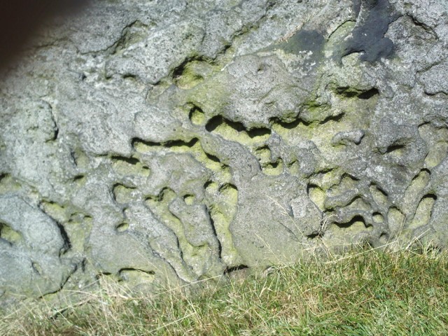
I saw patterns and weathered erosions in the rocks that i hadn’t noticed before. I took some time to study this rock- drawing & making rubbings . The gouged surface (vertical as you look at it) had the appearance of an aerial view of a landscape like The Grand Canyon (or am I just obsessed & deluded!), where there is a system of steep sided interconnected valleys framed by the cliffs with a relatively flat landscape on the top.
ok you do have to use your imagination a bit to see The Grand Canyon- I think you had to have been there! I will go back and make something of this but here is a drawing showing how I’ve attempted to describe the contours, convex & concave, as if this were a minute landscape.
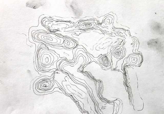
I didn’t try very hard , invention played a consciuos role here- this isn’t science, there were no measurements. Its visual mapping and interpretation- a record of how I saw this object that had suggestions of a hard landscape gouged out of its surface.
How was it formed? I need to get hold of a geologist……
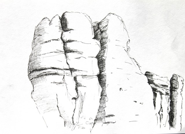
Anyway , I also used drawing in the traditional, objective, realistic fashion , trying to capture something of these beautiful rock giants.